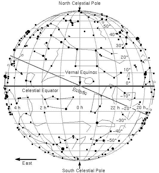
Onto this sphere we basically extend the Earth's system of latitude and longitude so we give coordinates, called Celestial Coordinates, to objects throughout the Universe.
In Celestial Coordinates though, we do not use the names latitude and longitude. Instead we use the names declination and right ascension. Like latitude, declination increases from 0 at the celestial equator (which is the projection of the Earths equator onto the Celestial Sphere), to 90 degrees at the North Pole, and decreases to -90 degrees at the South Pole.
Right Ascension corresponds to longitude on Earth. Longitude is measured in degrees, minutes (1/60 of a degree) and seconds (1/60 of a second), Right ascension is measured in hours and minutes. There are 24 hours of right ascension corresponding to an angle of 360 degrees around the celestial equator, so that an hour corresponds to an angle of 15 degrees.
The zero point for right ascension is the vernal equinox, the point on the Celestial Equator where the Sun crosses going from south to north, signalling the start of spring in the northern hemisphere. To find the right ascension of a star follow an hour circle "straight down" from the star to the celestial equator. The angle from the vernal equinox eastward to the foot of that hour circle is the star's right ascension.